Meta
Recent Comments
Categories
- "Big Daddy" Don Garlits (1)
- 1946 Tidal Wave (4)
- A.M. Patrick (2)
- abalone (1)
- Abalones (1)
- Able Body Pet Care (2)
- Andy Santana (1)
- Barbara's Fishtrap (1)
- Ben Bailey (1)
- boat building (1)
- Bobby Franko (1)
- Burt Blumert (1)
- Coastside development (1)
- Coastside Fishing Club (3)
- Coastsider.com (1)
- Collin Tiura (2)
- Crab Cottage (3)
- Crab Landing (1)
- Deb & Michael Wong (2)
- Dennis McShane (1)
- Elaine Martini Teixeira (1)
- Erich von Neff (2)
- Ernie Mangue (1)
- Extreme Kayaking (1)
- F.E. Booth Company (1)
- Fishermen (1)
- Fran "Buzz" Young (7)
- Frank Celestre (2)
- Friends of the Calamari (1)
- Galen Wolf (1)
- George Dunn (1)
- Golden Gate Abalone (1)
- Gray Gardner (1)
- Half Moon Bay Bakery (1)
- Half Moon Bay Brewing Co. (1)
- Harbor Village Books (1)
- Henry Bettencourt (1)
- Henry Cowell (1)
- Henry Doelger (1)
- Idas (1)
- Joanne Franklin (1)
- Joe Cordova (1)
- John Vonderlin (3)
- Katherine Middleton (1)
- Kelly Groves (1)
- Ketch Joanne (1)
- Larry & Jim Fortado (1)
- Leland & Cecily Parsons (1)
- Lorraine Piegaia (1)
- Mark Andermahr (1)
- Mavericks (2)
- MD (1)
- Mezz Luna (1)
- Mich (1)
- Michael Bowen (1)
- Michael Koepf (2)
- Michael Powers (1)
- Miramar Beach (1)
- Miramar Hotel (1)
- Mystery of Half Moon Bay Documentary (1)
- Nerli's (1)
- Oceano Hotel & Spa (2)
- Pete Forchini (1)
- Pillar Point (10)
- Pillar Point Breakwater (8)
- Princeton Packers (3)
- Princeton-by-the- (1)
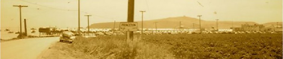
- Princeton-by-the-Sea (22)
- Princeton-by-the-Sea characters (2)
- Red Abalone (1)
- Richard Henry (1)
- Rob Tillitz (3)
- Robbie Bergerson (1)
- Robert L. Wiegel Coastal Slide Collection (1)
- Rydal Hall (1)
- San Mateo County History Museum (1)
- San Mateo County Supervisor Rich Gordon (1)
- South City Blues Band (1)
- Spring Mountain Gallery (1)
- Sr. (1)
- Stacy Trevenon (1)
- Steve Carusa (1)
- Susan Pate (1)
- the book (1)
- The Daisy (1)
- The Fisherman's Son (1)
- The Irene (3)
- Tom Monaghan (1)
- Transitions (1)
- Uncategorized (278)
- Vincent Carusa (1)
- William M. Wilson (1)
Category Archives: 1946 Tidal Wave
April 1, 1946 Eastern Aleutian Is. Tsunami Damage…
from NOAA click here April 1, 1946 Eastern Aleutian Is. Tsunami Damage along the Alaska, British Columbia, Washington, Oregon, and California coasts See References for information sources. Location Amplitude (m) Damage Summary Unga, AK 0.8 Dock and boats washed away. … Continue reading
Posted in 1946 Tidal Wave, Princeton-by-the-Sea
Comments Off on April 1, 1946 Eastern Aleutian Is. Tsunami Damage…
…1946 Tidal Wave at Princeton….
Thank you John Vonderlin for sending this…(email John: [email protected]) From “United States Tsunamis” 1946, April 1, 12:29. A magnitude 7.8 earthquake in the Aleutian Islands generated a 30-m tsunami on Unimak Island that destroyed Scotch Cap Lighthouse. In California the … Continue reading
Posted in 1946 Tidal Wave, Princeton-by-the-Sea
Comments Off on …1946 Tidal Wave at Princeton….
1946: April Fool’s Tidal Wave: Coast Keeps Midnight Watch on High Tide
Tuesday, April 2, 1946 From the San Mateo Times: “Princeton. April 2–Coastside residents today were taking the cycle of total waves in stride. Consensus of opinion was that there was nothing they could do about it, individually or collectively. After … Continue reading
Posted in 1946 Tidal Wave, Princeton-by-the-Sea
Comments Off on 1946: April Fool’s Tidal Wave: Coast Keeps Midnight Watch on High Tide